1. Land Overview
2 of 4 FilledCapture clear views of the complete site perimeter and ground.
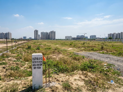
GPS: 28.4391° N, 77.4882° E
2. Boundary & Corner Markers
Linked to Step 3 GPSCapture visible boundary pillars or fencing mapped in Step 3.
Corner Marker P1 (North-West)
Target GPS: 28.439180° N, 77.487920° E
P5
Stone Pillar (PLOT B-12)
VerifiedLinked to Vertex P5 • 11:18 AM
±2.8m Accuracy logged
Fence
Northern Edge Wire Fencing
Physical Barbed Wire • Height 5 ft
Captured at 11:20 AM3. Road & Approach Access
Frontage DocumentedDocument road connectivity, width, surface, and entry frontage.
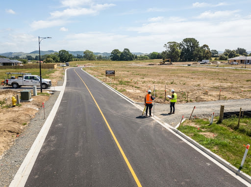
Sector 150 Connecting Arterial
11:22 AM • GPS 28.4390° N, 77.4880° E
Plot Direct Entry Frontage
Capture direct curb-cut / plot interface
4. Surrounding Area & Development
Immediate context within 200m radius of Sector 150.
5. Issue & Risk Evidence
Auto-Linked Step 2Auto-linked from physical condition checks recorded in Step 2.
Ground Slope & Soil Grading
Saved Locally"Grading depth < 1.5 ft required. Natural soil is dry and firm. No water stagnation observed."
6. Site Walkthrough Video
OptionalRecord 360° pan along plot frontage towards center with active heading log.
Note: Uploaded videos are flagged as secondary gallery proof
Up Next: Step 5
Nearby Facilities & Connectivity
Record proximity to metro, schools, expressways